
World’s first drone to reach the stratosphere climbs 34,245 feet for weather data
Swiss weather technology company Meteomatics has unveiled a multicopter drone that it says reached an...
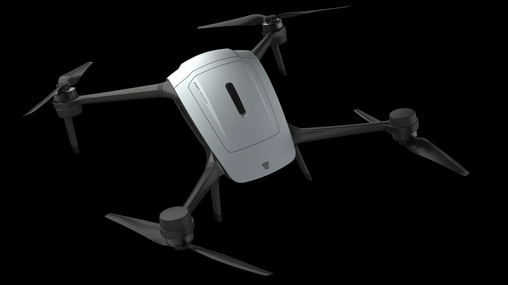
Swiss weather technology company Meteomatics has unveiled a multicopter drone that it says reached an altitude of 34,245 feet (10,438 meters), allowing it to collect atmospheric data at heights normally monitored by weather balloons.
Called Strato, the aircraft is designed to measure temperature, humidity, air pressure, and wind speed as it climbs through different layers of the atmosphere. Meteomatics claims it is the first multicopter capable of collecting atmospheric profiles from near the ground to the stratosphere.
The drone can withstand sustained winds of up to 80 mph and uses an active de-icing system to prevent ice from building up on its propellers. These features are designed to keep it operating in the cold, windy conditions encountered at high altitudes.
Unlike conventional weather balloons, which drift with the wind and are generally not recovered for reuse, Strato can fly toward a selected location, collect measurements, and return to its launch site. The company says this allows operators to gather weather data when and where they need it.
Flying through extreme conditions
Strato uses an aerodynamic body and active wind controls that allow it to orient itself into strong headwinds. The system is designed to maintain flight stability while collecting measurements at different altitudes.
Its integrated de-icing system automatically heats the propellers when icing conditions are detected. The aircraft also features a water-resistant design to support operations in rain and other wet conditions.
Throughout the flight, Strato sends real-time telemetry to its operator, including altitude, wind conditions, temperature, and icing alerts. This allows operators to monitor the aircraft and atmospheric conditions during ascent and descent.
The company has not disclosed Strato’s battery capacity, flight endurance, payload weight, or the conditions under which it reached its reported maximum altitude. It also has not provided independent verification of its claimed altitude record.
“Ten years ago, a drone that effectively flew into the stratosphere to collect weather data was a pipe dream. Today, we’ve made it a reality,” said Dr. Martin Fengler, CEO of Meteomatics.
Replacing fixed balloon schedules
Weather balloons carrying instruments called radiosondes remain a primary method of measuring conditions high above Earth’s surface. These instruments record atmospheric conditions as the balloons rise, but launches generally follow fixed schedules.
That leaves gaps between observations, particularly in the upper troposphere, where fast-moving air currents can affect weather systems and aviation operations.
Strato is designed to address those gaps by collecting measurements at selected locations and times. Such observations could help airlines assess flight conditions and aerospace operators evaluate weather during launch preparations.
Meteomatics says the collected data will also support its high-resolution weather forecasting models, US1k and Euro1k. The models are designed to provide localized forecasts using atmospheric measurements and other weather information.
Strato joins the company’s existing Meteodrone and Meteodrone Tropo aircraft, expanding the altitude range covered by its drone-based observation systems.
The company has not released comparative data showing how much Strato improves forecast accuracy over existing observation methods. Its reported 34,245-foot flightnevertheless demonstrates the altitude capability Meteomatics is seeking to bring to reusable atmospheric measurement systems.
Source: https://interestingengineering.com/innovation/weather-drone-34245-feet-strato-meteomatics
Related articles

Anthropic launches free AI security scans for open-source projects
Anthropic's offering to help open-source projects track down security vulnerabilities with a new service called OSS Scanner.

Apple will reportedly debut its first touchscreen MacBook in three weeks
Apple is set to introduce a new MacBook Pro with a touchscreen and an updated iPad Mini "on or around" October 27th, Bloomberg reports.

AMD will bring FSR 4 to handhelds by the end of 2026
It's already possible to get AMD's framerate-enhancing FSR 4 boost on handhelds as old as the Steam Deck - but in June, AMD reserved the right to disappoint handheld gamers by not officially bringing…

Ranked: iPhone Duo Prices Around the World
See how iPhone Duo prices vary worldwide, from $1,999 in the U.S. to $4,689 in Türkiye, and why taxes drive the gap.

Microsoft’s new Windows Search is exactly what Windows 11 needs
Windows Search has been one of the most frustrating parts of Windows 11, and now Microsoft is addressing this with a significant overhaul.

California is trying to shut down robot vs. human cage matches
The California State Athletic Commission sent a cease-and-desist letter to a startup that hosted a match between a human and a robot last month, as reported by The New York Times.